GEOWiZ Consulting

Surpac Google Earth Tools

Google Earth is a free software program that lets you fly anywhere on Earth to view satellite imagery, maps, terrain and 3D buildings. When used in conjunction with SURPAC, it becomes a very powerful 3D GIS tool that can be used for storing, displaying and printing all of your exploration and mining data.

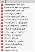
Any data created in SURPAC can be exported to Google Earth including string point data, string line data and string polygon data, all DTM’s and 3DM models as well as saved screen images. Any other images taken from PDF’s for example can be imported to SURPAC and geo-referenced and then exported to Google Earth. More complicated 3D models created in programs such as Sketchup can also be imported to SURPAC for geo-referencing and then exported to Google Earth.

High quality images can be saved from Google Earth and imported into SURPAC for geo-referencing. Google Earth also provides some useful digitising tools and any digitised data can be exported directly to SURPAC strings.

For more details and examples, download a slide show. The system comes with detailed tutorials and demo data.
Dynamic Anisotropy Estimation

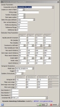
GEOWIZ have developed a Dynamic Anisotropy Estimation macro in SURPAC that has been used on a number of projects such as the Los Calatos Cu-Mo Porphyry project in Peru, see page 7 of Metminco ASX Announcement for details.

For the Los Calatos project, the orientation of the main breccia zones varied considerably in strike and dip. Normally, the breccias would have been sub-domained but the Dynamic Anisotropy Estimation (DAE) method allowed the orientation of the search ellipsoid and the variogram model to be defined individually for each block in the model.

A number of other macros are used to assign the dip and dip azimuth values into the block model.

The DAE method was developed by Collaroy Computing in the Surpac macro scripting language and uses the enhanced Ordinary Kriging functions within Surpac 6.7 to interpolate the blocks.

Aerial Photography

GEOWIZ have completed a number of aerial photography projects for mining and construction companies providing a high quality video and still photography presentation for websites and reports.

This includes filming at a remote, high altitude project site in Southern Peru where numerous fly overs were undertaken to record and document the areas that have been disturbed as well as to create a video for inclusion on the company website.

GEOWiZ is currently documenting the construction of a major building project in Sydney with regular monthly fly overs to record the progress.

GEOWiZ has also undertaken a number of projects for farmers and coastal management.

Database Solutions

GEOWIZ have developed a large number of sophisticated databases in Microsoft Access that are being used on various operations around the world. In many cases, the databases have been linked directly with SURPAC eg. ore block grades can be read directly from SURPAC block models into the production system and grades can be tracked to the stockpiles.

Other databases such as tenement and drill holes are linked to Google Earth so information stored in the database can be automatically viewed in Google Earth.

  • Tenement management system - direct link to Google Earth
  • Drill hole database - flexible and easy to use front end
  • Drill hole logging system - link to main drill hole database
  • Core photo management system
  • File management database - specifically for on-line data rooms
  • Open cut and underground grade control and production management system